10/16
- Copyright
- Creative Commons (BY-NC-SA)
- Created on
- Friday 20 February 2009
- Posted on
- Friday 20 February 2009
- Dimensions
- 1012*941
- File
- flickr-3296048526.jpg
- File size
- 176 KB
- Keywords
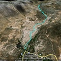
- google earth, meiringspoort, Pass, South Africa
- Visits
- 1180
- Rating score
- no rating
- Rate this photo


0 comments
Add a comment