121/521

Screenshot
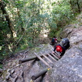
- Copyright
- Creative Commons (BY-NC-SA)
- Created on
- Sunday 16 April 2017
- Posted on
- Sunday 16 April 2017
- Dimensions
- 1192*668
- File
- flickr-33260143483.png
- File size
- 71 KB
- Albums
- Visits
- 3046
- Rating score
- no rating
- Rate this photo
0 comments
Add a comment